
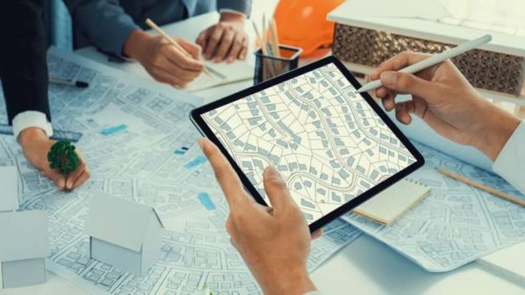
Urban planning is an intricate process that involves the design and development of cities and towns, focusing on maximizing space, resources, and sustainability. In this context, geometric informatics has become an invaluable tool, enhancing the efficiency and effectiveness of urban planning. Geometric informatics leverages geometric algorithms, spatial data analysis, and advanced computational techniques to solve real-world problems, enabling better decision-making, optimized designs, and sustainable urban growth. Here are the top ways geometric informatics is revolutionizing urban planning:
Efficient Land Use and Zoning
Urban planning involves determining the most effective way to use available land for residential, commercial, recreational, and industrial purposes. Geometric informatics helps urban planners analyze spatial data and make decisions based on geometric relationships between various land uses.
- Spatial Analysis: Geometric informatics can analyze large datasets on land use patterns, population density, and topography. This helps identify areas that are underutilized or poorly planned, allowing planners to allocate land more efficiently.
- Zoning Optimization: With the help of geometric algorithms, planners can design optimal zoning regulations, ensuring that commercial, residential, and industrial areas are appropriately distributed to reduce congestion and enhance the quality of life.
By using geometric informatics to assess land use, cities can minimize urban sprawl, maximize available space, and create more harmonious, functional urban environments.
Transportation Network Design
Transportation is a critical aspect of urban planning, and geometric informatics plays a significant role in designing efficient transportation networks. From roads and highways to public transit systems, geometric algorithms optimize traffic flow, reduce congestion, and improve the overall connectivity of urban areas.
- Road Network Analysis: Geometric informatics tools help map and analyze existing road networks. These tools can identify traffic bottlenecks, evaluate intersections, and propose alternative routes to improve traffic flow and safety.
- Public Transit Systems: Geometric algorithms are also used to optimize public transportation routes, ensuring that buses, trains, and subways are efficiently located to serve the largest number of people with the least amount of energy or time.
Urban Heat Island Mitigation
The urban heat island effect occurs when cities become significantly warmer than their surrounding rural areas due to human activities, buildings, and infrastructure. Geometric informatics helps urban planners assess and mitigate this issue by analyzing temperature variations and proposing solutions for better heat distribution.
- Climate Modeling: Using geographic information systems (GIS) and geometric algorithms, urban planners can model how heat accumulates in different areas of a city. This allows them to target hot spots and introduce cooling measures, such as increasing green spaces or implementing reflective surfaces on buildings.
- Green Space Planning: Geometric informatics helps design urban green spaces, parks, and tree-lined streets in such a way that they maximize cooling effects and contribute to reducing the urban heat island effect. These interventions also improve air quality and provide recreational spaces for residents.
These applications help create more sustainable and livable cities by addressing climate challenges and improving residents’ quality of life.
Smart City Development
Smart cities leverage technology and data to improve urban living, making them more efficient, connected, and sustainable. Geometric informatics plays a critical role in enabling the development of smart cities by providing tools to integrate and analyze vast amounts of data from sensors, infrastructure, and residents.
- Sensor Networks and Data Collection: Geometric informatics enables the design of sensor networks that track traffic patterns, air quality, energy use, and more. These networks generate vast amounts of spatial data that help urban planners make informed decisions.
- Spatial Data Analysis: Geometric algorithms analyze the data collected by these sensors, identifying patterns and trends that inform urban policy decisions. For example, traffic congestion patterns or pollution hotspots can be mapped, leading to better infrastructure planning and resource allocation.
By enabling the efficient management of resources and infrastructure, geometric informatics supports the development of smart cities that can adapt to changing needs and improve the quality of life for their residents.
Sustainable Infrastructure Planning
Geometric informatics is also used to design and evaluate the sustainability of urban infrastructure. Sustainable infrastructure focuses on minimizing environmental impact, conserving resources, and improving the quality of life in cities.
- Energy Efficiency: Geometric informatics can help plan energy-efficient buildings and infrastructure by analyzing solar radiation patterns and optimizing the orientation of structures for natural light and heat. This contributes to reducing the city’s carbon footprint.
- Water Management: Geometric algorithms help map and manage water resources, ensuring that cities can optimize water distribution and reduce waste. By analyzing geographic data, planners can design more efficient drainage systems, stormwater management, and irrigation systems.
Through these methods, cities can create infrastructures that are more resource-efficient, resilient to climate change, and sustainable in the long term.
Disaster Risk Management and Resilience Planning
Urban areas are often vulnerable to natural disasters such as earthquakes, floods, hurricanes, and wildfires. Geometric informatics plays a crucial role in disaster risk management by helping cities prepare for and respond to these events.
- Risk Assessment: Using spatial data, geometric algorithms assess the risk of various natural disasters in specific urban areas. This helps urban planners identify high-risk zones and plan for evacuation routes, emergency services, and critical infrastructure that can withstand disasters.
- Simulation and Modeling: Geometric informatics tools also simulate the effects of natural disasters, allowing planners to evaluate how the city’s infrastructure and buildings would fare in the event of a disaster. These simulations help ensure that urban areas are resilient and prepared for emergencies.
Conclusion
Geometric informatics plays a transformative role in urban planning by providing planners with powerful tools to analyze, design, and optimize cities. From transportation networks and land use to disaster resilience and sustainability, geometric informatics allows for more efficient, livable, and environmentally friendly urban environments. As cities continue to grow and face new challenges, the integration of geometric informatics will be key to shaping the future of urban development and improving the quality of life for residents around the world.