As cities grow and evolve, integrating technology into urban planning and management has become crucial. Among the most transformative fields contributing to the development of smart cities is Geometric Informatics. This interdisciplinary field, which combines geometry, spatial data, and information systems, is essential for building efficient, sustainable, and responsive urban environments. This article will explore why geometric informatics is key to smart cities, its impact on urban planning, and how it enhances various city functions.

What is Geometric Informatics?
Geometric informatics is the study and application of geometric principles, data, and algorithms to solve problems related to space, geography, and urban systems. It involves the use of geographic information systems (GIS), spatial data analysis, and 3D modelling to create accurate representations of urban spaces. These technologies are essential for analyzing, visualizing, and optimizing the design and operation of smart cities.
Geometric informatics makes it possible to collect, analyze, and interpret spatial data in ways that provide valuable insights into how cities function. From managing traffic flows to planning infrastructure development, it uses geometric models to simulate real-world urban dynamics.
Optimizing Infrastructure Planning and Development
In the context of smart cities, infrastructure planning is a primary concern. Geometric informatics aids in the design, simulation, and optimization of infrastructure projects such as roads, buildings, utilities, and public spaces. By leveraging spatial data and 3D models, urban planners can assess the most efficient and sustainable ways to develop and manage urban infrastructure.
For example, 3D modelling can help visualize how new buildings or roads will impact the surrounding environment, including traffic patterns, pedestrian flow, and environmental sustainability. This predictive capability allows cities to optimize infrastructure development and minimize potential issues before they arise, reducing costs and increasing overall urban efficiency.
Enhancing Transportation and Traffic Management
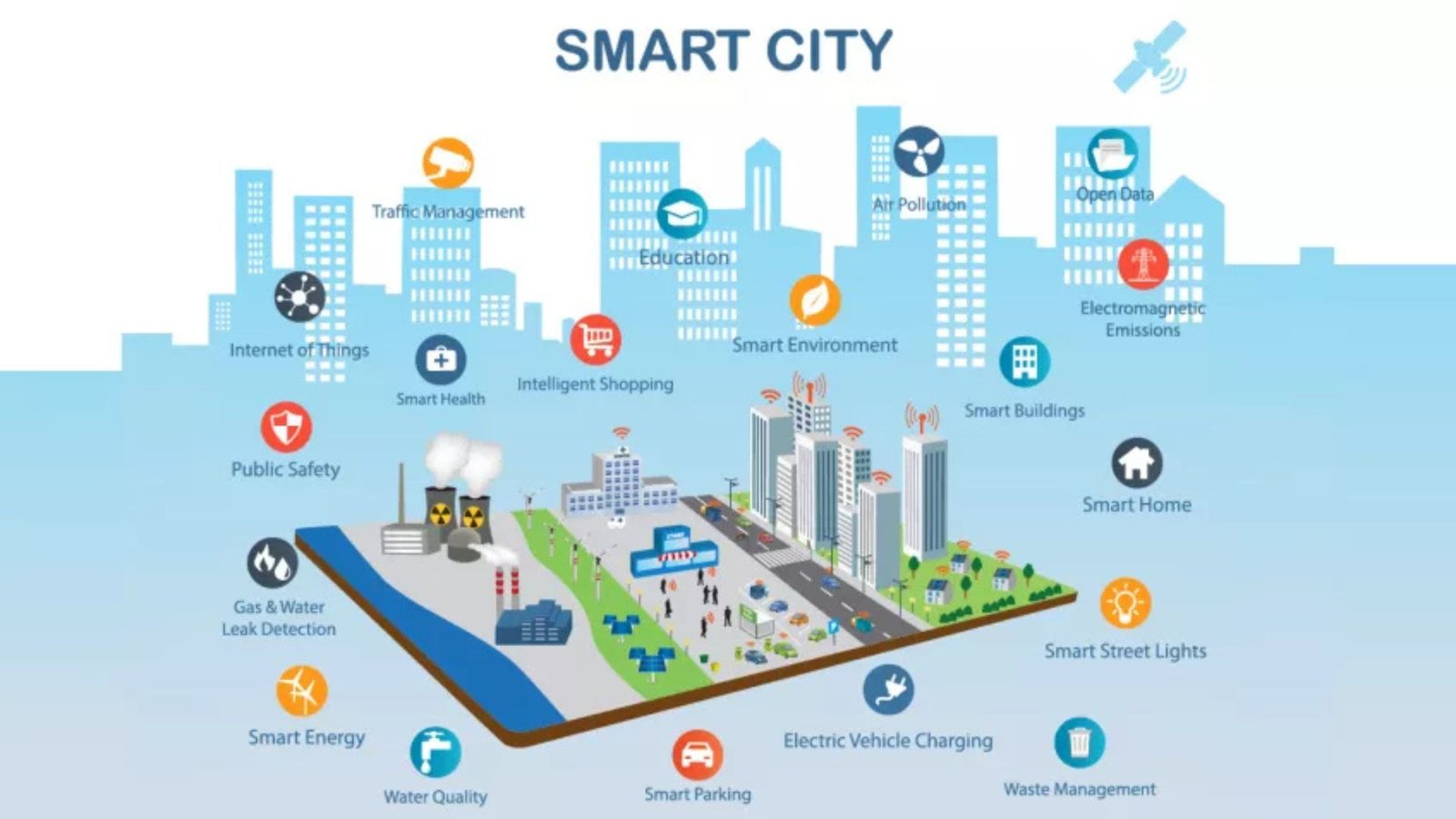
One of the most notable benefits of geometric informatics in smart cities is its ability to improve transportation and traffic management. By utilizing real-time data and spatial analytics, cities can optimize the flow of traffic, reduce congestion, and enhance the overall efficiency of public transport systems.
Geometric informatics plays a crucial role in developing intelligent transportation systems (ITS). These systems integrate data from sensors, cameras, and GPS devices with spatial data to provide live traffic updates, predict congestion, and optimize traffic signals. Moreover, autonomous vehicles and smart parking systems are also powered by geometric informatics, enabling smoother transportation and a more sustainable city environment.
Advancing Sustainability through Spatial Analysis
Geometric informatics helps cities achieve sustainability goals by enabling better resource management and reducing environmental impact. By analyzing spatial data, urban planners can make informed decisions about land use, energy consumption, water management, and waste disposal.
Smart grid systems, powered by geographic information systems (GIS), allow for the efficient distribution of electricity, while spatial analysis can optimize water conservation strategies by identifying areas of waste. Moreover, by using geospatial data to assess the environmental impact of construction projects, cities can adopt eco-friendly practices, such as optimizing green spaces or reducing emissions through more efficient public transport.
Improving Public Safety and Emergency Response
Geometric informatics plays a critical role in enhancing public safety and emergency response systems within smart cities. By integrating spatial data with real-time information, cities can develop systems that anticipate and respond to emergencies more effectively.
For example, GIS-based systems can track fire or police vehicles, ensuring the fastest routes are taken during an emergency. Furthermore, predictive models can help anticipate disasters like floods or earthquakes by analyzing past data and identifying high-risk areas. This enables authorities to take preventive measures or deploy resources where they are most needed.
Conclusion
Geometric informatics is undeniably crucial to the development and functioning of smart cities. By integrating advanced spatial data, 3D modeling, and real-time analytics, cities can optimize infrastructure, enhance sustainability, and improve overall urban management. As technology continues to evolve, the possibilities for using geometric informatics to create smarter, more resilient cities are endless. For urban planners, city officials, and citizens alike, understanding and embracing this field is key to shaping the future of urban living.


